Distance: 200 miles – Travelling time: 0630 – 1710 – Temperature range: 6 – 31°C

A village clinging to the hillside – it was unusual to see coloured walls
Setting off from our riverside lodgings at 0630 we headed back up the valley with a degree of thrill and some trepidation towards the climb up to Babusor. The views were breath taking in the early morning, if chilled, sun. Murray drove the car very skillfully up the endlessly winding and climbing pass until we reached the police check point marking the end of the KPK and the start of Gilgit Baltistan (GB) – the true Northern Areas and the start of the Karakorum mountain range.


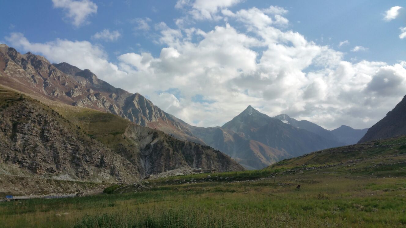
Early morning in Naran Valley

Breath taking views

Murray and our trusty chariot!

You can just make out an old settlement made of stone in the hillside

By chance we stopped next to this ‘mile’ stone: 960km to Kashi (Kashgar)

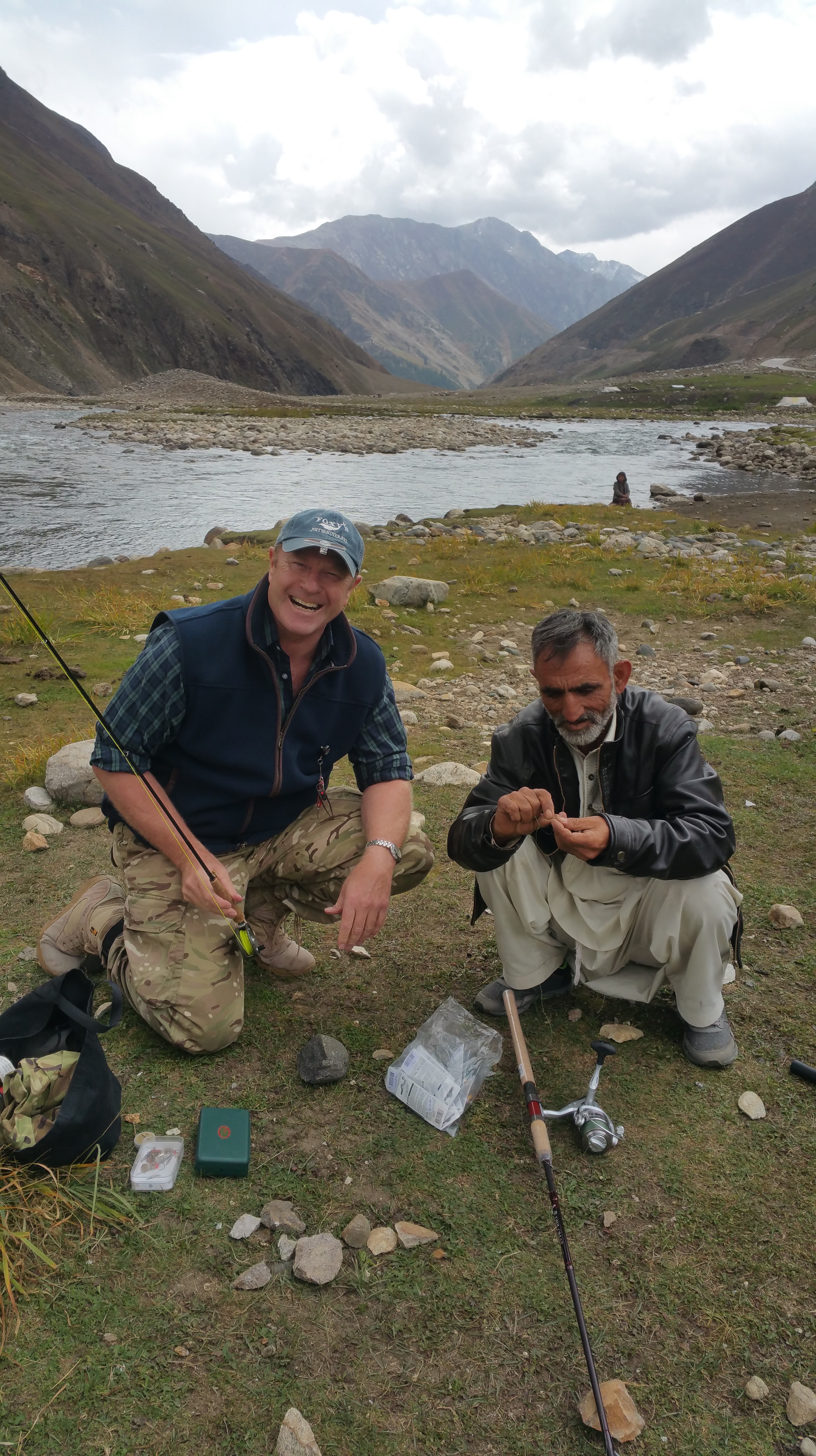
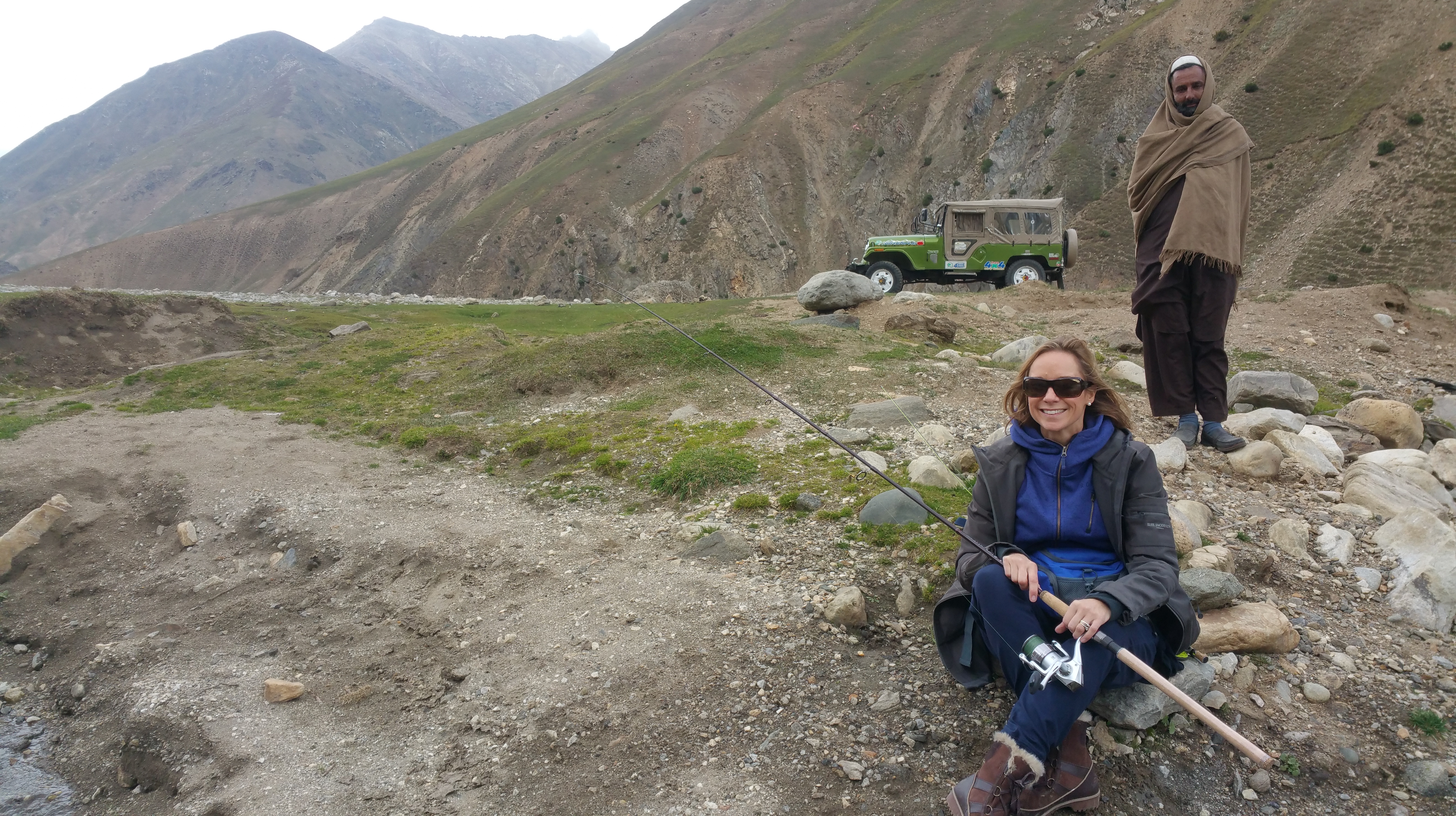
Taken while still trying to catch a fish!
At the Babusor Pass checkpoint we were tersely instructed by the guards to pull over and a short interrogation began. Our papers were checked, and re-checked, and a book was dutifully filled out with our details before we were instructed to sit down and drink truly filthy sweet chai and to eat fried chapattis, again it was best not to think too much about it! The police were incredibly hospitable and kind. Thanks to Murray’s great forethought we were carrying booklets from the British High Commission ‘Shared History, Shared Future; 70 years of Pakistan and UK relations’ – filled with photos and received with ‘aahhhs’. Inspired!
Murray using his charms to placate less than friendly guards. Result: an accompanied breakfast!
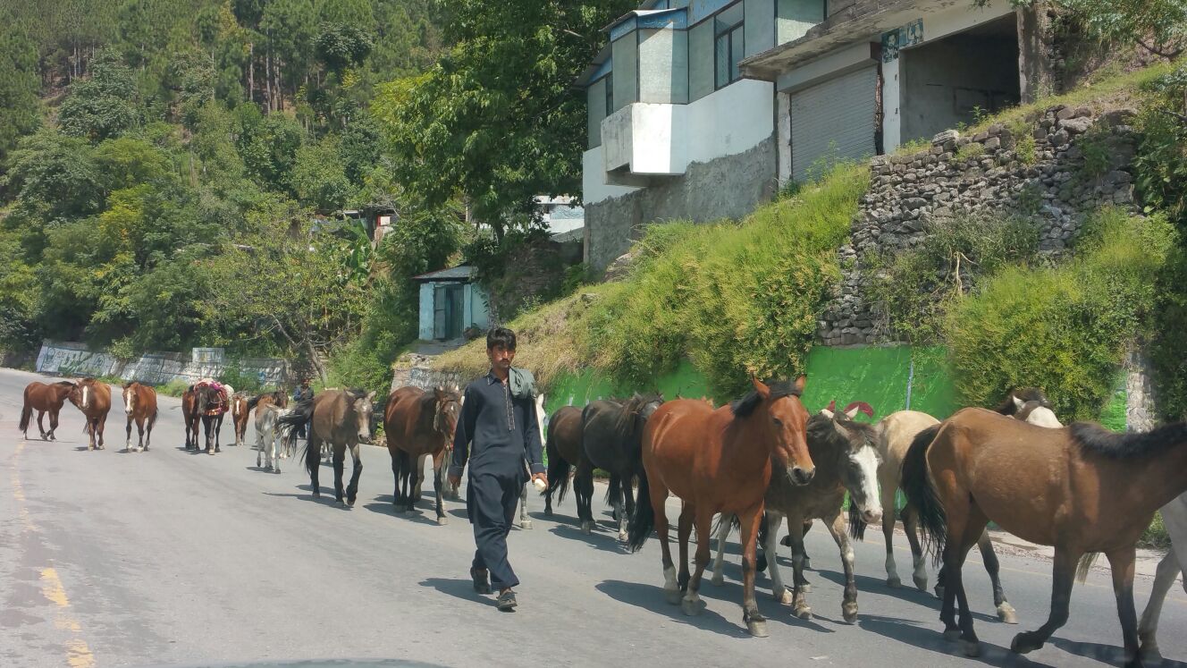
Descending the Babusor Pass with some relief after our steep and isolated ascent we entered Gilgit Baltistan. The landscape changed immediately with clusters of houses clinging to cliff faces, red rooftops and patches of beautiful terracing fed by clever irrigation channels. The men here wear the traditional pakol hat (rather like a pancake with a rolled rim), now much in evidence. We wound our way down through the hairpin bends on pretty good road surfaces until we reached the Chilas intersection with the KKH. After a short stop at the check point we were issued with passes from the GB police to see us through all the check points until the boarder crossing at Dih, deep in the Khunjerab National Park.

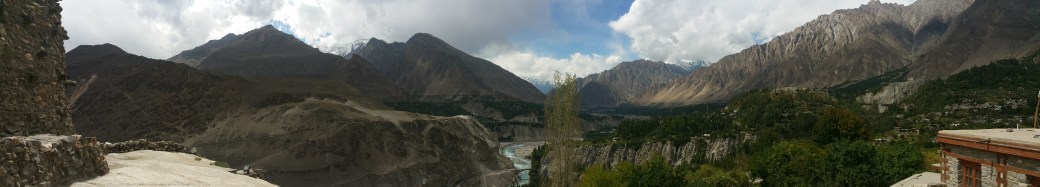
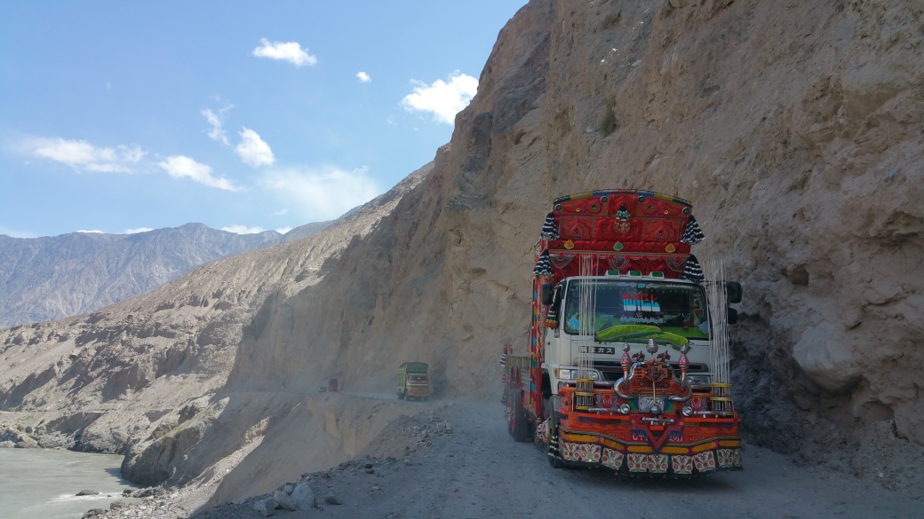
Joining the KKH was a rude awakening! With little metalled road it was a slow and white knuckle inducing ride throughout, negotiating locals driving at relative speed and jingly trucks often at pinch points all the while with a sheer drop into the mighty Indus River far below – and not much of a crash barrier for protection. Halfway between Chilas and Gilgit we crossed the Indus over a new bridge and here the road surface improved immeasurably and we were able to make good progress, sighting the mountain Nanga Parbat behind us and the convergence of the Himalayas, the Karakorum and Hindu Kush ranges, to the point where we branched off, still on the KKH, towards Hunza up the Nagar Valley.


At the confluence of the rivers Gilgit and Indus where the mountain ranges collide
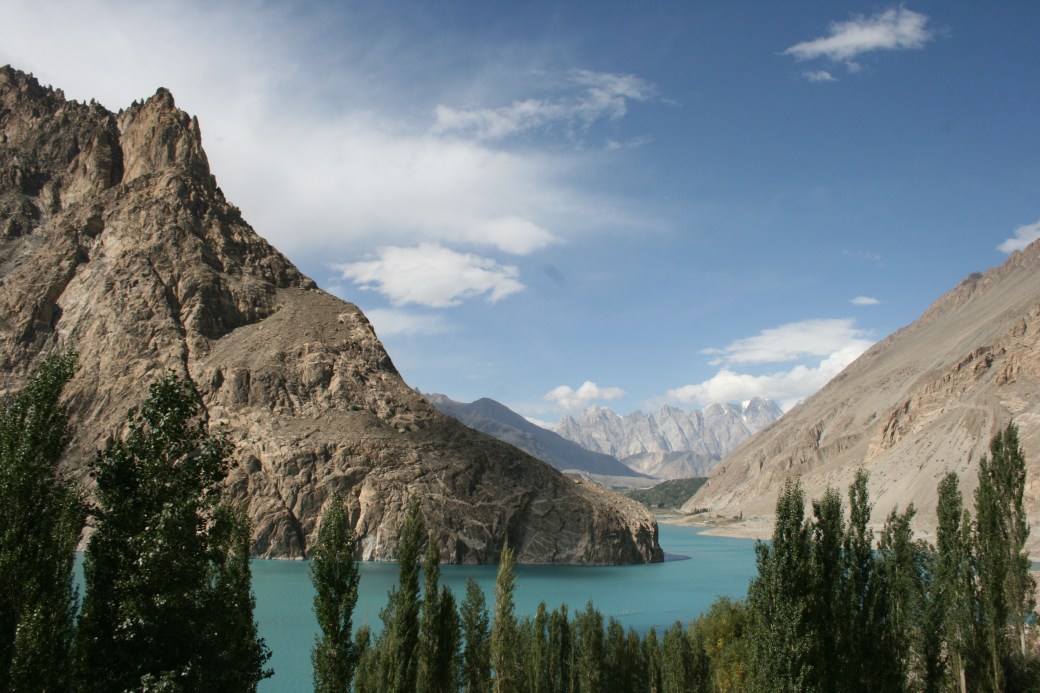
The engineering of the KKH is a remarkable feat of human engineering pitted against the forces of nature. The road follows the Hunza valley in a deep gorge faced by the Hindu Kush mountains to the left and the Karakorum range to the right. Following ancient trails the Chinese began to build the road in the 1960s and 1970s and since then with much human sacrifice, together with the Frontier Works Organisation of Pakistan, and now with Chinese funding the Chinese Pakistan Economic Corridor (CPEC), the road is continuously repaired and rebuilt from the frequent landslides and the metalling of the road has continued all the way to the border with China.
The memorial to the Chinese workers who perished building the Karakorum Highway
We made it to Karimabad in the Hunza district within two hours from Gilgit, having stopped in the village of Ghulmet to have lunch at the Rakaposhi viewing point where we revisited what was our temporary accommodation during the landslides in 2015. This time the weather was beautiful, but a sighting of the summit of Rakaposhi still eluded us! By sheer chance we met Ali, the guide who, with his family, was so kind and hospitable and put us up when we were stuck in the landslides during our previous visit in 2016.
Onwards to Karimabad and to the Serena Hotel for the night.
Murray and Ali at the Rakaposhi viewing point